The Asante Akim North District Assembly (AANDA) is one of the newly created districts in Ghana. It was carved out of the then Asante Akim North Municipal Assembly in 2012, to form part of the 260 Metropolitan, Municipal and District Assemblies (MMDAs) in Ghana.
It was established by LI 2057 and inaugurated on 28th June, 2012. Agogo is the administrative capital of the District and forms part of the 43 MMDA’s in the Ashanti Region.

The District is situated at the Eastern part of the Ashanti Region and its’ eastern borders form part of the boundary between the Ashanti Region and the Eastern Region of Ghana. It shares boundaries to the North, with the Sekyere Kumawu and Sekyere Afram Plains Districts, to the East with Kwahu East District; to the South with Asante-Akim South and Asante-Akim Central and finally to the West with Sekyere East District.
The district is located in the Eastern part of Ashanti Region and lies between latitude [6°60’N and 7°30’N] and longitude [0°15’W and 01°20’W]. It covers a land area of 1,125 square km. The proximity of the district to Eastern Region provides ready markets for its agricultural produce.
List of Districts and Map of The Ashanti Region
Ashanti Region Map

List of Districts in Ashanti Region
| Adansi Asokwa | Ejisu Juaben Municipal |
| Adansi North | Ejura Sekyedumasi Municipal |
| Adansi South | Juaben |
| Afigya Kwabre | Kumasi Metropolitan |
| Afigya Kwabre South | Kwabre East District |
| Ahafo Ano North Municipal | Kwadaso |
| Ahafo Ano South | Kwahu Afram Plains South |
| Ahafo Ano South East | Mampong Municipal |
| Ahafo Ano South West | Obuasi East |
| Akrofum | Obuasi Municipal |
| Amansie Central | Offinso Municipal |
| Amansie South | Offinso North District |
| Amansie West | Oforikrom |
| Asante Akim Central | Old Tafo |
| Asante Akim North | Sekyere Afram Plains |
| Asante Akim South | Sekyere Central |
| Asokwa | Sekyere East |
| Atwima Kwanwoma | Sekyere Kumawu |
| Atwima Mponua | Sekyere South |
| Atwima Nwabiagya | Suame |
| Atwima Nwabiagya North | |
| Bekwai Municipal | |
| Bosome Freho | |
| Bosomtwe |
District Map of Asante Akim North

The District in National Context

The Economy
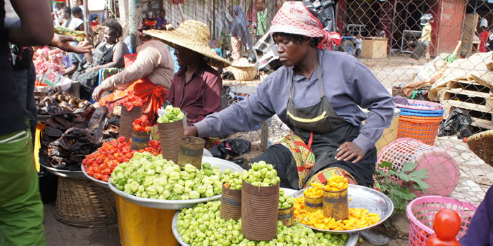
Asante Akim North is basically an agrarian economy. Agriculture employs about 72.7 percent of the total labour force; after which comes the Service sector employing roughly 20 percent of the population, this leaves about 7.3 percent of the working population in the industrial sector.
Majority (79.7%) of the rural households within the total rural population are engaged in agriculture. Notwithstanding this fact, a sizeable proportion (64.4%) of the urban households is also engaged in agriculture.
Physical and Natural Environment
Climate
The monthly average rainfall is between 120 mm and 150 mm. Combining temperature and rainfall regimes, four seasons are distinguishable within the district micro climate.
They are: 1. The harmattan season (Dec- April), 2. the first rainy season (May- July with the peak in June), 3. the monsoon drought (July – August) and 4. the second rainy season (Sept. – Nov).
The soils which support vegetation cover and crops, are the product of parent rocks and climate conditions. The rich soils and the favourable climatic condition have combined to make possible the cultivation of all kinds of crops.
Apart from Bediesi Sutana Association and Yaya Pimpimse Association which best support cereals and legumes, the rest of the soils can support oil palm, cassava, plantain, vegetables, citrus and maize.
Beyond Agogo and indeed some parts of the Afram Plains, the most prevalent type of soil is the savannah ochrosol. This soil is well leeched and richly supplied with organic matter nutrients.
It supports yam, maize cassava, plantain, vegetables and groundnuts very well.
Cashew as a nontraditional export crop can also grow well in this portion of the District.
Relief and Drainage
Topographically, the district is undulating, ranging between 305 and 610 metres and it is interrupted by a stretch of the Akwepim-Mampong Ridge.
The Akwapim- Mampong Range serves as a watershed for the numerous rivers and streams in the district. The District is drained by such rivers as Oweri and Afram.
The existence of rivers in the district is a potential for the construction of dams for irrigational purposes. The steep slopes at Kyiriyawa near Hwidiem and Onyem have created waterfalls which are yet to be developed as tourist sites.
Vegetation
The District lies within the moist semi-deciduous forest belt. The major vegetation types are the A. Open Forest over the highland areas, the B. Closed Forest on the range and the C. Wooded Savannah.
Tree species found in the forest are Wawa, Ofram, Otie, Sapele, Sanfina, and Onyina among others.
The original forest of the district has degenerated into secondary forest due to indiscriminate logging of trees, inappropriate farming methods and bush burning. In order to maintain the microclimate, parts of the forests in the district have been reserved namely;
- The Bandai Hill in the north which covers an area of 160.8 sq. km
- The Bandai Hill in the west which stretches for 72.8 sq. km and Onyemso and Dome
- River Reserves which covers an area of 15.5 sq. km
Population
According to the 2010 population and housing census, the total population of Asante Akim North District is 69,186. This represents 1.4 percent of Ashanti Region’s population. The District has five communities assuming urban status using a population of 5000 as a basis. They are Agogo, Domeabra, Juansa, Hwidiem and Wioso
The Asante Akim North District is one of the 260 Metropolitan, Municipal and District Assemblies (MMDAs) in Ghana, and forms part of the 43 of MMDAs in the Ashanti Region.
The District with its capital as Agogo is situated at the eastern part of the Ashanti region. Its eastern boarder forms part of the regional boundary dividing the Ashanti and Eastern Regions.
The district covers a total surface area of about 1217.7 square kilometers (472.4 sq miles) which form about five percent (5%) of the total area of the Ashanti Region, and 0.5 percent of the total area of the country. The built environment consists of 369.482 square kilometers with the natural environment forming 848.218 square kilometers of the total land area.
The District also shares common boundaries on the north and north-west with Asante Akim North District and Kwahu South District on the west. On the south-west lies Bekwai Municipal and on the south-east is Birim North District in the Eastern Region.
The population of the district according to the 2010 Population and Housing Census stands at 117,245 With 57,951 males 59,294 females.
Leadership of The Assembly

The Chief District Executive
Hon. Francis Oti Boateng

The Member of Parliament
Mr. Appiah Kubi

The Presiding Member
Hon. Frank Gyamfi

The District Coordinating Director
Mr. Johnson Nyarko
The Asante Akim North District Assembly has undertaken a great number of projects in all areas of district to improve the living standards and conditions of its peoples.
Education
Several projects have been initiated and completed on education These include:: A six Classroom block and 2 unit quarters at Nyyisaeso, six Unit teachers quarters at Domeeabra, contd
Health
Under health, The District Health Directorate at Agogo has been completed,, a construction of Health Insurance Office at Agogo, CHPs compounds have been constructed at Pekyerekyere, Brantuokrom and equipment provided for these and other CHP compounds…
Agriculture
Cashew and Cocoa nursing sites have been setup, cocoa seedlings have been freely distributed to farmers
Water and Sanitation
The Assembly has constructed mechanized bore holes and overhead tanks at Agogo Central Market, Russia Park and Ananekrom under the Covid 19 Fund.. Contd..
Security
The new District Police Station at Agogo was commissioned not long ago
Local Economic Development
Construction of a warehouse at Agogo , One District one factory and a new market at Juansa are a few of the initiatives carried out
Energy
Rural Electrification Projects involving the extension of electricity to thirty three communities in the district
Road Construction
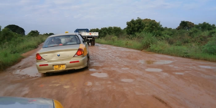
Clearing and reshaping of roads continue in the district. A 6km between Ananekrom and Nsonyameye is ongoing.. The Abrewpong Bridge is under construction and a steel Bridge has been constructed at Agogo Zongo
Social Interventions
Donations to people with disability is a regular activity carried at by the District Assembly
Governance
A new office for the Electoral Commission has been built
Education
Several projects have been initiated and completed on education These include:: A six Classroom block and 2 unit quarters at Nyyisaeso, six Unit teachers quarters at Domeabra, Four Unit teachers Quarters at Nhyiaso, 3 Unit Classroom Block at Behwe.

Domeabra Teachers Quarters
HEALTH

Agogo Health Directorate
AGRICULTURE

Cocoa Nursery
WATER AND SANITATION

Mechanized Bore Hole Agogo Juansa Pekyerekye
LOCAL ECONOMIC DEVELOPMENT

Warehouse at Agogo
ENERGY

Rural Electrification Project
ROAD CONSTRUCTION

Road Construction 6km Ananekrom – Nsonamyeye
SOCIAL INTERVENTION

Social Intervention
GOVERNANCE

Construction of Electoral Commission Office
SECURITY

Commissioning of New District Police Station


Source: Ashantibiz
Submit your stories or articles to us via WhatsApp


